top of page

A Visual Catalog of the Fauna and Flora of Yantacaw Brook Park in Montclair, NJ


This visual catalog is my certification project for the Rutgers University Environmental Stewards Program. The purpose of this visual catalog is to highlight how important Yantacaw Brook Park is as both an environmental and community resource.
Yantacaw Brook Park isn't just any park. If one takes the time to observe while visiting here, it will become apparent just how diverse its fauna and flora are. It is home to a multitude of animals, insects and plants, including the ephemeral trout lily and the endangered wood turtle.
The Lenape Trail runs through the park and Yantacaw Brook, a tributary of Third River, also known as the Yantacaw River, connects to the Passaic River and provides water and habitat for the dwellers of this beautiful 11.5 acre oasis.


HISTORY:
The area where Yantacaw Brook Park is located was a golf course at the turn of the 20th century. When the Upper Montclair Country Club relocated to Clifton, a parcel of its estate was dedicated as a public park. Evidence of the park's history as a golf course can be seen in the street names surrounding it, For example, Greenview Way, The Fairway and Club Road (which leads to the main entrance of the park). Click here for detailed information concerning the golf course from the Yantacaw Brook Park Conservancy's site.
VISITING YANTACAW BROOK PARK:
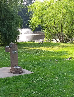
The park is located in Montclair, New Jersey at 30 Club Road (just off of Grove Street) and there is parking along Club Road and Yantacaw Brook Road. There is a large pond, six park benches and a water fountain. There are no picnic tables but you are welcome to bring a blanket and have a picnic nevertheless.

Map of Yantacaw Brook Park

Outline of Yantacaw Brook Park

Outline of the former golf course, circa 1927(for clarity, click on the image above)
bottom of page